Seems we just can't get enough of that Chalcolithic culture. On our Saturday off (July 28th), most of us hit the road for the site of Rogem Hiri (Hebrew) or Rujm el Hiri (Arabic). The site is located northeast of the Sea of Galilee. C, our field supervisor, has dug at the site before. This was great since, although the site is on the map, it is shown in the middle of nowhere. Luckily we got there without a misstep. After our adventures which included fording a stream and looking for cattle bones to study, we had a falafal and mezze lunch at a road side diner near the Sea of Galilee.
More information about the site is available at http://www.mfa.gov.il/MFA/History/Early%20History%20-%20Archaeology/Rogem%20Hiri%20-%20Ancient-%20Mysterious%20Construction and http://digs.bib-arch.org/digs/rujm-el-hiri.asp.
Monday, July 30, 2012

Thursday, July 26, 2012
Mid season update
As we approach the middle of the season, we have been taking low level aerial photographs using a 7m photo mast. These photos are used to create 3 dimensional models of the site. Below is a screen capture showing a top down view of a 3d model of areas AA and BB as they were on the morning of 7/24/12:


Wednesday, July 25, 2012
Rowe-Clark Math & Science Academy at Marj Rabba!
This year at Marj Rabba we have the biggest team ever - 24 people!! We have students from UChicago, DePaul, Cornell College, a college in New Jersey, and 6 special guests from the Rowe-Clark Math & Science Academy in Chicago (http://www.roweclark.org/). These five students and their intrepid administrator, Ms. D. made the long journey (everyone had to get their first passport) to "experience" archaeology in Israel. Drs. Yo and Mo and Prof. Stein of the OI met with them throughout February and March for a mini "what is archaeology" course, so they had some idea of what to expect - but the real thing is nothing like this candy survey in the Lasalle-Banks Room at the OI.
The students and the amazing Ms. D. arrived on July 12 and started work in the field bright and early the next day at 5:30am. The following are some shots of the Rowe-Clark students and Ms. D. doing various things on site. Almost over night they have become "archaeologists" and have (or are) receiving training in all things archaeology.
As part of the Marj Rabba outreach program we try to engage with all kinds of people interested in learning about the Chalcolithic of the Galilee. We have been somewhat successful in having local visitors from Karmi'el and surrounding small towns and villages visit the site. We also get a lot of visitors from fellow archaeologists, but having the Rowe-Clark students with us is another example of outreach that we archaeologists often overlook: people in our own backyards (Chicago) who might be interested in archaeology in Israel. Thanks - Ms. D., E, M, H, S, and K, for all of your hard work this season, you all are real troopers!!
 |
| Candy survey at the OI |
 | ||||||||||||||||
| R-C students and Ms. D at the OI |
 |
| Drink water and wear a hat - the most important field lessons according to K! |
 |
| Ms. D. at the sieve |
 |
| E uses a small pick to explore in area CC |
 |
| M trowels around in Area CC |
 |
| H takes points and reads the total station for elevation data |
 |
| S holds the prism for H - archaeology is team work! |
Saturday, July 21, 2012
Week Two
We’ve finished our second week of excavations. We put our excavation skills to work clearing a runway for the model airplane which will be used for aerial photography of the site. After excavating, we attended a few lectures – Dr. Dina Shalem told us about Chalcolithic pottery; Dr. Yorke Rowan told us about the Chalcolithic Period and how to mark lithics; and Dr. Samuel Gazit of Ort Braude College told us about the College’s study abroad program for engineers (check out http://overseas.huji.ac.il/JGE).
We had some fun too – we took a tour of Tell Akko (known locally as Napoleon’s Hill). After the tour, some of us went to explore Tell Akko, some of us went to Tel Aviv, and some of us hung out at Ort Braude College to catch up on our sleep.
Fun with Flotation with Dr. PG!!
 | ||
| Dr. PG demonstrates flotation |
 |
| Flotation in action |
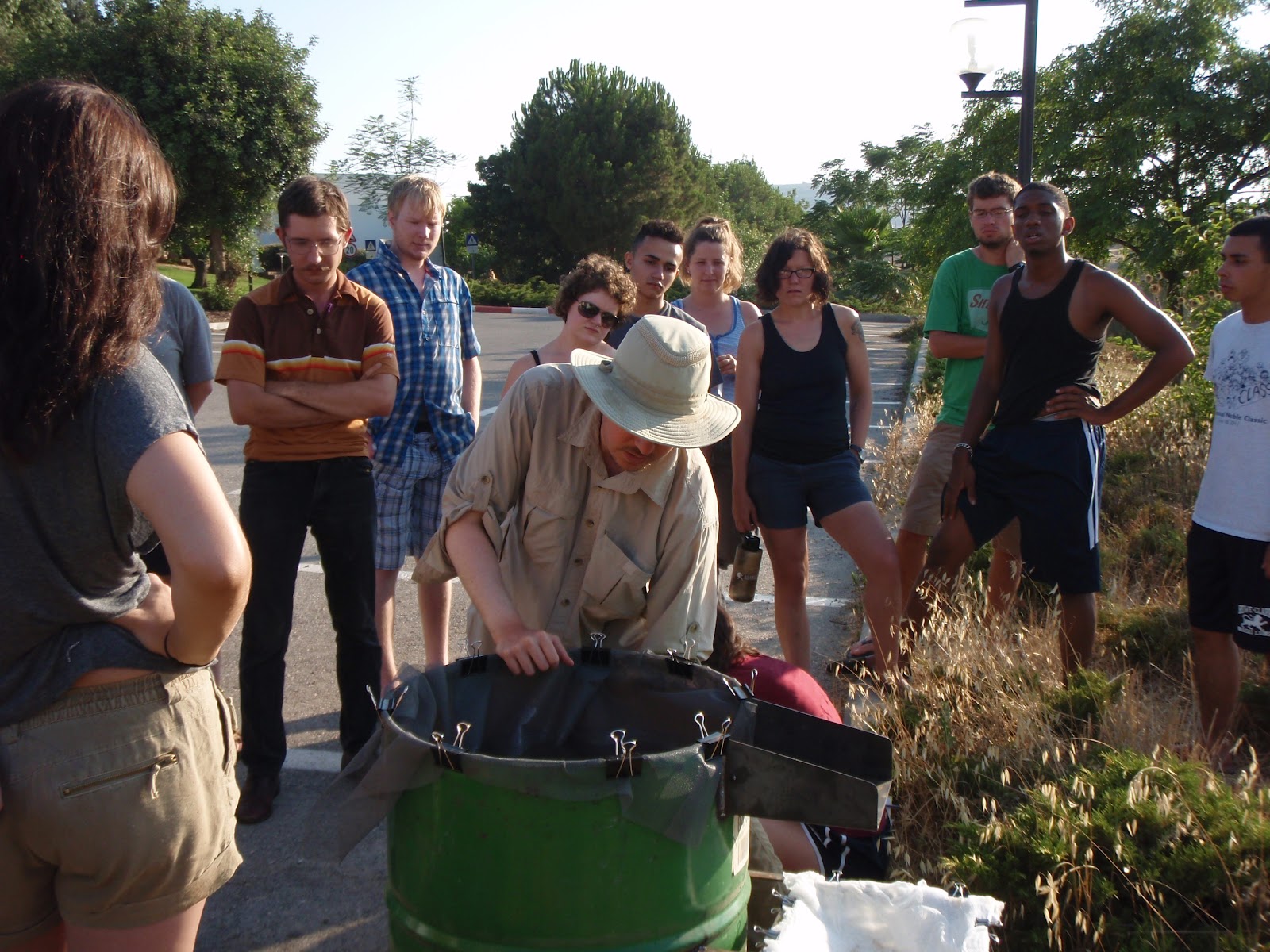 | ||||
| Dr. PG sets up the flotation machine |
 | ||
| Dr. PG with the flot in cheesecloth |
Sunday, July 15, 2012
Up in the Sky
Here is a photo of our celestial companions who have been following us on our drive to the excavation site these past few days. On Sunday, Jupiter appeard to be sitting in the crescent moon. We have binoculars powerful enough to see the moons of Jupiter strung out like pearls around the planet.

Thanks to Adler Planetarium in Chicago for the photo.

Thanks to Adler Planetarium in Chicago for the photo.
3d Photogrammetry and Archaeology
One of our projects for the 2012 season is to begin utilizing 3d photogrammetry to record our excavation units and individual features preserved at the site. This is done using exciting new software packages which can build highly accurate 3d models from sets of two dimensional photographs taken with regular digital cameras. Here is one of the first examples of a 3d model of a single feature at the site. This is a stone lined pit that was excavated in 2010 and 2011. To best view the model, click the full screen icon in the top right corner and then click and drag anywhere to move the model around:
Subscribe to:
Posts (Atom)